Becoming Bakerton: The First Settlers
PART ONE: Olde Bakerton
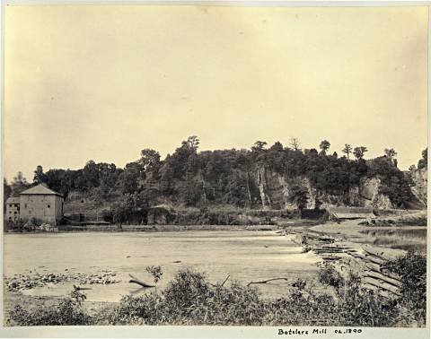
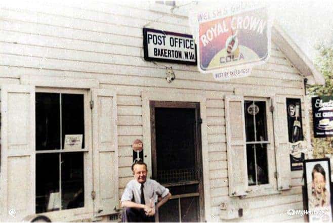
Bakerton is a small, little-known unincorporated town on the outskirts of Harpers Ferry. The “blink and you might miss it” community, unbeknownst to even many locals, has an almost forgotten, admirable and profound history.
In the early years, the Bakerton area went by the name Oak Grove. Full of high-quality limestone, mineral deposits, and fertile land, the land in this beautiful section was practically begging for industrialization. But, a dense population of hostile Native Americans delayed industrialization.
Industry began to pick-up in the Oak Grove area in the 1760s with the earliest quarrying, smelting of iron ore, and agricultural production. During its budding years, Oak Grove was a mostly quiet agrarian community. According to inventories, wheat was the most important and abundant crop in the area, followed by corn.
Although Oak Grove and the surrounding areas maintained its agricultural industry throughout the years, Friend’s Iron Ore Bank and multiple quarries proved most lucrative during Bakerton’s golden years with the majority of its residents contributing to the industries in some form. Until the mid-1900s, Bakerton remained practically self-sufficient.
But. it wasn’t until the entry of the Baker family that Bakerton bore its name.

In 1706, Swiss explorer Francis Louis Michel gathered several Pennsylvania woodsmen and traveled along the west bank of the Potomac River. Searching for land for a Swiss colony, he reported that Indians covered the area.
A temporary camp was set up by Michel and his explorers at Harpers Ferry. Although other settlers had likely passed through the vicinity, Michel was the first to explore and map the land thoroughly.
Even though settlement in the area was prohibited during this time, Michel’s report of bountiful natural resources of the area caught the eye of many settlers in the vicinity. By 1719, a small Presbyterian community and church had formed near Shepherdstown. The colony was dubbed Potomoke.
In 1722, the Six Nations surrendered all claims to land in the Eastern Panhandle by signing the Treaty of Albany with Virginia, allowing whites to settle south of the Potomac River and, debatably, between the Blue Ridge and Allegheny mountains.
The first actual permanent settler to the Bakerton area is a hotly debated topic. Evidence points most strongly to Israel Friend. Having developed a fruitful relationship with Native Indian tribes, Israel most likely settled here as early as the 1720s.
Israel was appointed as an Ambassador to the Shawnee Indians in 1725 by Governor Calvert of Maryland. Two years later, on January 10, 1727, the Chiefs of the Five Nations deeded Israel land in Washington County, Maryland, at the “mouth of Antietam”. According to legend, the original deed was carved into a section of birch bark. The property, which lies near Pack Horse Ford across from Knott Island, was surveyed by “arrow shoots”, meaning the furthest an Indian could sling an arrow. The land measured 200 arrow shoots along the river with a depth of 100 arrow shoots. The back of the property followed Antietam Creek into the Potomac River. There, Israel built a gristmill.
Although Israel was likely the first permanent settler and had been deeded land from the Indians, John Van Metre was the first to receive a land grant to the area. In 1730, Van Metre was granted a total of 20,000 acres, including parts of present-day Shepherdstown, Bakerton, and Harpers Ferry, as well as portions of present Berkeley County.
At a council held in the capitol the 17th day of June, 1730. Present ---- The Governor, Robert Carter, James Blair, William Byrd, John Robinson, John Cart, Rd. Fitzwilliam, John Grymes, Wm. Dandridge, John Curtis, ---- Esquires. Several petitions being this day offered to the Board for leave to take up land on the River Sherando on the Northwest side of the Great Mountains, Robert Carter, Esq. Agent for the Proprietors of Northern Neck moved that it might be entered that he on behalf of the sd Proprietors claimed the land on the sd River Sherando as belonging to the sd Proprietors & within the limits of their Grant it belonged sole to the Proprietors to grant the sd lands wch moven at his request is entered and then the Board proceded to the hearing of the sd Petitions. On reading at this Board the Petition of John Van Metre setting forth that he is desirious to take up a Tract of land in this Colony on the West side of the Great Mountains for the settlement of himself and eleven children and also that divers of his Relations and friends living in the Government of New York are also desirous to move their families and effects and Settle in the same place if a Sufficient Quanity of land may be assigned them for that purpose and praying that ten thousand acres of land lying in the forks of the Sherando River including the places called by the name of Cedar Litch and Stoney Lick and running up between the branches of the said river to complete that quantity and twenty thousand acres not already taken up by Robert Carter and Mann Page, Esqrs., or any other, ---- lying in the fork between the sd River Sherando and the River Cohonguroota and extending thence to Operkon and up the South Branch thereof may be assigned for the Habitation of himself and family and friends. The Governor, with the advice of his council is pleased to give leave to the sd John Van Metre to take up the sd first mentioned tract of ten thousand acres for the set’lem’t of himself and his family, and that as soon as the Petitioner shall bring on the last mentioned Tract twenty families to Inhabit on that this Board is satisfied so many are to remove thither leave be and it is hereby granted him for surveying the last mentioned tract of twenty thousand acres within the limits above described in so many dividens as the pet’r and his sd partners shall think fit. And it is furthered ordered that no person is permitted to enter for or take up any part of the afsd Lands in the meantime provided the sd Van Metre and his family and twenty other families of his Relations and friends do settle thereon within the space of two years according to his proposal. Isaac Van Meter of the Province of West Jersey having by petition to this Board set forth that he is desirous to settle himself on the West side of the Great Mountains. He has been to view the land in those parts and has discovered a place where settlement may conveniently be made, not possessed by any one of the English Inhabitants and praying that ten thousand acres of land lying between the lands surveyed for Robt. Carter, Esq., and the forks of the Shenando river and the river Operkon in as many several tracts or Dividends as shall be necessary for the accommodation and settlement of ten families (including his own) who propose to bring to said land: The Governor with the advice of the Council is pleased to order as it is hereby ordered that the said Isaac Van Meter for himself and his partners have leave to take up the said quantity of ten thousand acres of land within the limits above described and that if he bring the above number of families to dwell there within two years; Patent be granted him and them for the same in such several tracts or Dividends as they shall think fit and in the meantime the same be referred free from entry of any other person, Dated at Williamsburg, 17th June, 1730.
By June 12, 1734, Jost Hite, a German immigrant previously residing in York, Pennsylvania, had purchased a large amount of Van Metre's land and had established the number of families necessary to meet the patent.
Among the families settled by Jost was Peter Stevens, a trader from Germany, who chose the "point" of present-day Harpers Ferry, effectively gaining squatter's rights to the area. There, Peter built a small log cabin. The point was nicknamed "the hole" and "Peter's hole" due to the low elevation of the area, which is only 247 feet above sea level.
Hite allowed families to choose the boundaries of their land -- a move challenged by Lord Fairfax. Fairfax argued that Hite's method of land settlement would leave the less desirable land unsaleable and demanded a rectangular plot system. Although a privy council was sympathetic to Fairfax in 1745, Jost won the challenge in court after the American Revolution allowing his property owners full title to their chosen lands.
During this period, Israel Friend and Samuel Taylor were also the recipients of land grants. On October 3, 1734, Samuel Taylor was granted two tracts of land totaling 325 acres. In 1732, Taylor had built a log cabin on the 125-acre tract near Moler Crossroads. Taylor, a Pennsylvania transplant, was a close friend of Gersham Keys, who later owned much of present-day Bolivar. Taylor ran a ferry on his property.